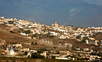
Santorini (Greek Σαντορίνη, pronounced [ˌsa(n)do̞ˈrini]) is a small, circular archipelago of volcanicislands located in the southern Aegean Sea, about 200 km southeast from Greece's mainland. It is also known as Thera (or Thira, Greek Θήρα [ˈθira]), forming the southernmost member of the Cyclades group of islands, with an area of approximately 73 km² (28 mi²) and a 2001 census population of 13,670. It is composed of the Municipality of Thíra (pop. 12,440) and the Community of Oía (Οία, pop. 1,230, which includes 268 inhabitants resident on the offshore island of Therasia, lying to the west). These have a total land area of 90.623 km², which also includes the uninhabited islands of Nea Kameni, Palaia Kameni, Aspronisi, and Christiani (all part of the Municipality of Thira). Santorini is essentially what remains of an enormous volcanic explosion, destroying the earliest settlements on what was formerly a single island, and leading to the creation of the current geological caldera. Its spectacular physical beauty, along with a dynamic nightlife, have made the island one of Europe's tourist hotspots.
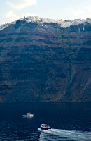
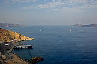
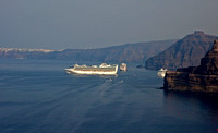
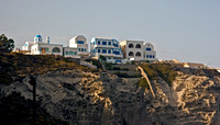
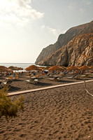
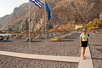
A giant central lagoon, more or less rectangular, and measuring about 12 km by 7 km (8 mi by 4 mi), is surrounded by 300 m (984 ft) high steep cliffs on three sides. The island slopes downward from the cliffs to the surrounding Aegean Sea. On the fourth side, the lagoon is separated from the sea by another much smaller island called Therasia; the lagoon merges with the sea in two places, in the northwest and southwest. The water in the centre of the lagoon is nearly 400 m (1300 ft) deep, thus making it a safe harbour for all kinds of shipping. The island's harbours all lie in the lagoon and there are no ports on the outer perimeter of the island; the capital, Fira, clings to the top of the cliff looking down on the lagoon. The volcanic rocks present from the prior eruptions feature olivine and have a notably small presence of hornblende.[2]
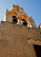
It is the most active volcanic centre in the South Aegean Volcanic Arc, though what remains today is chiefly a water-filled caldera. The name Santorini was given to it by the Latin empire in the thirteenth century, and is a reference to Saint Irene. Before then it was known as Kallistē ("the most beautiful one"), Strongylē ("the circular one"), or Thera.
The island is the site of one of the largest volcanic eruptions the planet has ever seen: the Minoan eruption (sometimes called the Thera eruption), which occurred some 3,600 years ago at the height of the Minoan civilization. The eruption left a large caldera surrounded by volcanic ash deposits hundreds of feet deep and may have led indirectly to the collapse of the Minoan civilization on the island of Crete, 110 km (70 miles) to the south, through the creation of a gigantic tsunami. Another popular theory holds that the Thera eruption is the source of the legend of Atlantis.